Fast Processing
Postprocess your project for optimal results with the quickest GPR processing tool in the market. Designed for working with large 3D GPR projects and dramatically reduces the time required for extracting information from the data.


Examiner™ Specialist is designed to easily process and analyze large GPR projects and still be the fastest GPR processing software in the industry. It provides a 3-dimensional, georeferenced view of the high-quality data captured with our sensors. A three-slice view allows users to easily navigate within the data volumes for detailed analysis and to export their data into actionable reports. Combine Examiner Specialist with Kontur Orbit, our AI-based SaaS solution, to unlock the full power of subsurface insights.


Examiner Specialist is regularly updated with new features. Download the latest version of Examiner Specialist to access all new features and efficiency improvements. *Requires an active license or support package.


Postprocess your project for optimal results with the quickest GPR processing tool in the market. Designed for working with large 3D GPR projects and dramatically reduces the time required for extracting information from the data.
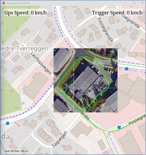
Explore large-scale GPR projects in a georeferenced environment. Allowing for reporting to be accurate. Positioned and decisions made using coordinate systems.
Process data while collecting. Postprocess your project for optimal results with the quickest GPR processing tool in the market. Designed for working with large 3D GPR projects and dramatically reduces the time required for extracting information from the data.
Wide selection of processing options for filtering, background removal and 3D migration. Make processing easy thanks to a dedicated preview window and to the possibility to create, save and share processing templates.
The most advanced software in the industry for postprocessing and interpretation of GPR data, designed for working with large and advanced 3D GPR projects. Customizable processing templates enables processing during data capturing, and significantly reduces post processing time. A wide selection of processing options for filtering, background removal and 3D data migration makes advanced post processing easy.
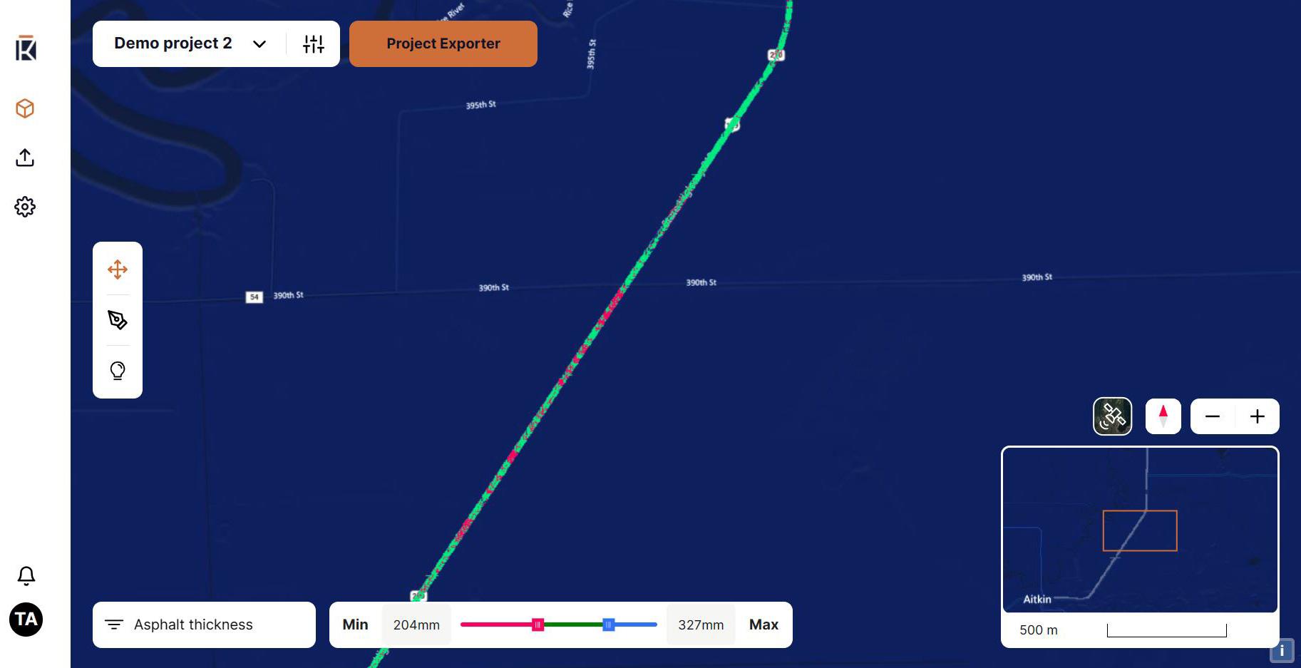
The fastest GPR processing software in the market designed for optimal processing speed with large multiple georeferenced 3D data sets. Analysis and interpretation in multiple georeferenced views of real-time data renderings for identification and tracing of features throughout the entire data set.
The Examiner Specialist™ features tools that assist our customers' key tasks.
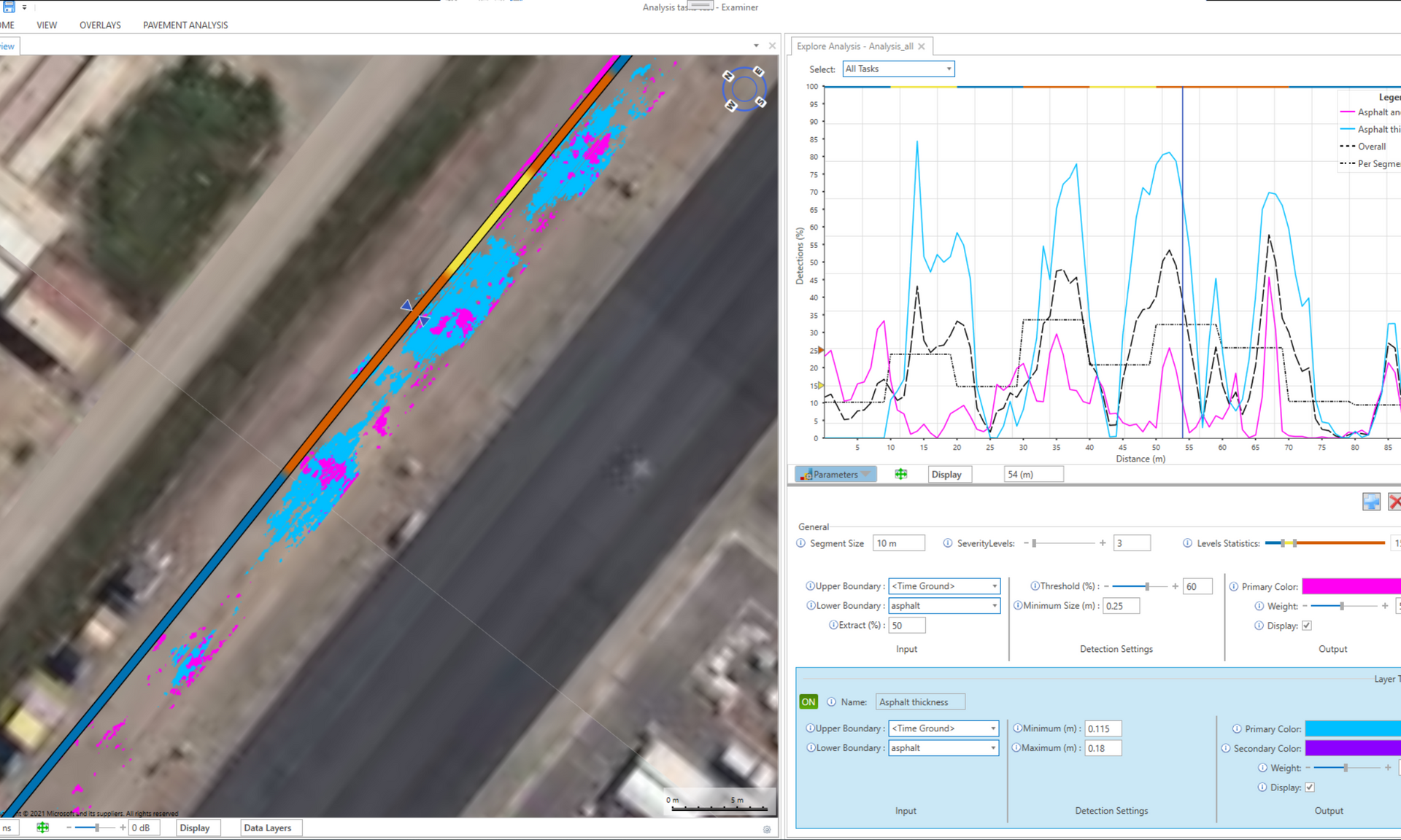
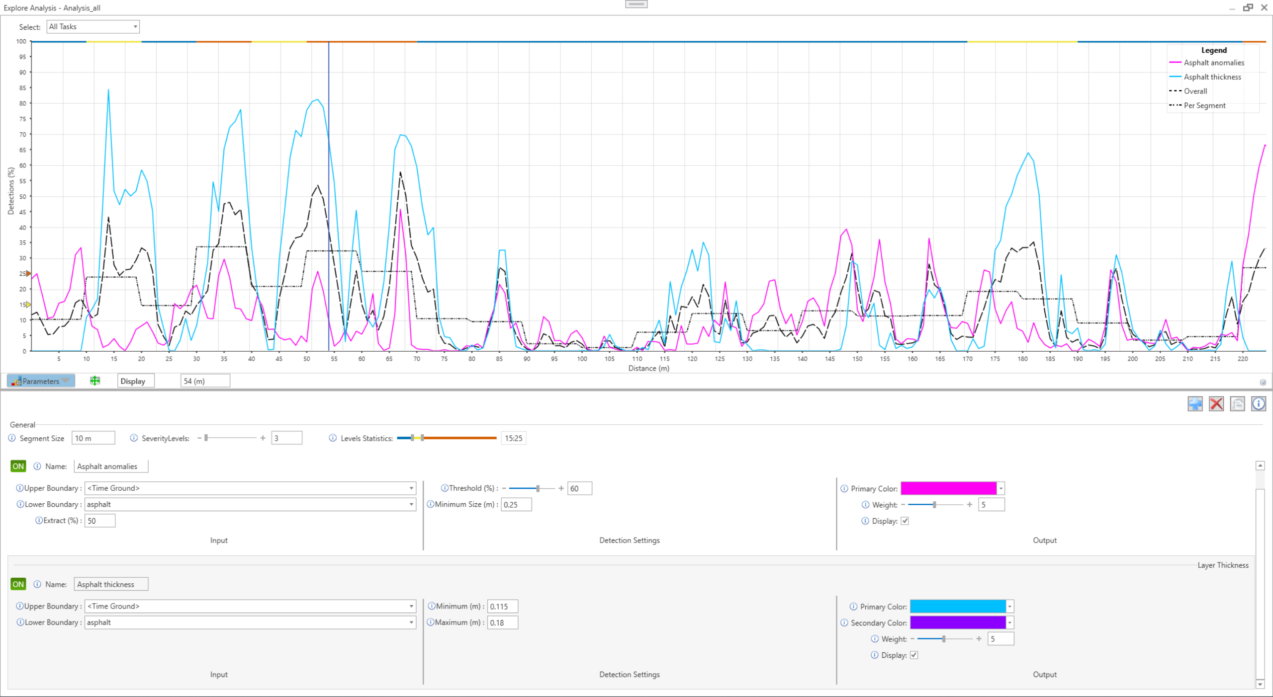
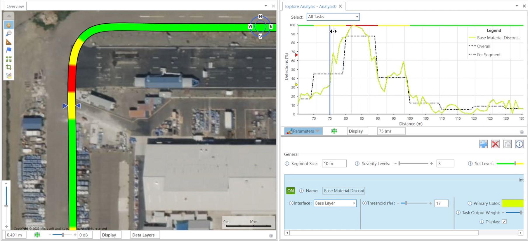
For instance, it provides Pavement Analysis features that are designed to assist in understanding conditions and changes in the thickness of pavement projects.
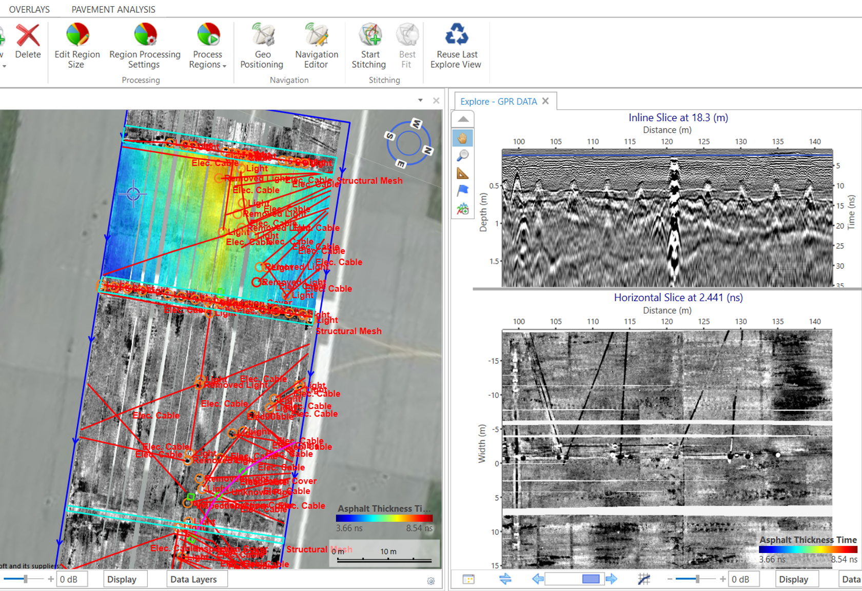
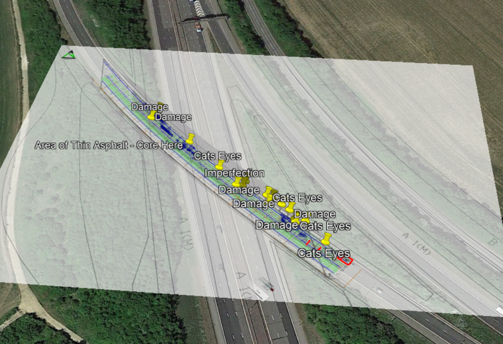
Annotate objects and areas in 3D. Map the location of buried utilities and infrastructure. Annotations are georefencered and can be used to pinpoint locations of interest to help inform project decisions. Add a colour code, a name and more to keep track.
Map layers of the subsurface rapidly using interface tracing tools. Get colour maps displaying the variation in thickness and amplitude.
Examiner Specialist™ provides export options to all common format types and platforms used in the industry. Including GIS (Shapefile/GeoJSON), CAD (DXF/DWG), SEG-Y, ASCII and Google Earth (KMZ).
Interfaces can also be saved as simple matrices or point clouds of the subsurface.
You can also purchase a computer from us, contact us for more information.

OS
Windows 10 (from Version 20H2) and Windows 11,64-bit (x64) versions

CPU
64-bit, Intel Core i7 (rec.)

MEMORY
MEMORY 16 GB or greater

DISK CAPACITY
Rec. min 250 GB SSD