Sensors

Introducing – Kontur Mk6 Series

Kontur is proud to introduce our newest line of GPR sensors - The Mk6

At Kontur, we push the boundaries of subsurface investigation, fulfilling a vision of making GPR more accessible and easy to use, even for non-specialists. As the next step in this journey, we are very proud to introduce the latest line in GPR sensors - the Mk6. Mk6 product series is not available in the USA. Pending FCC approval. Mk4 product series is available globally.

Sensor Details

Sensor details

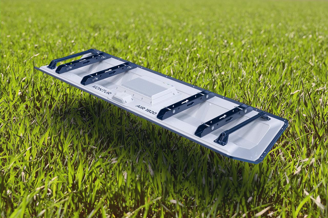
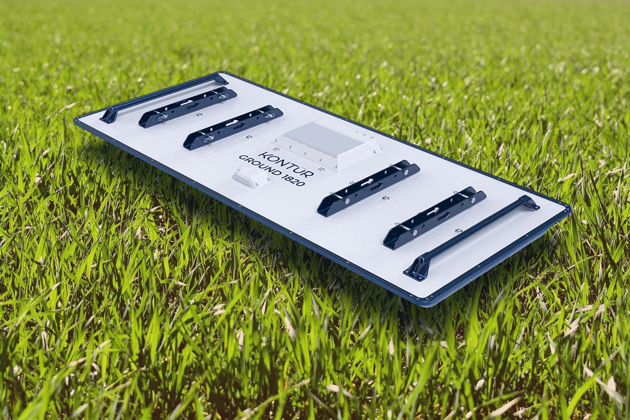
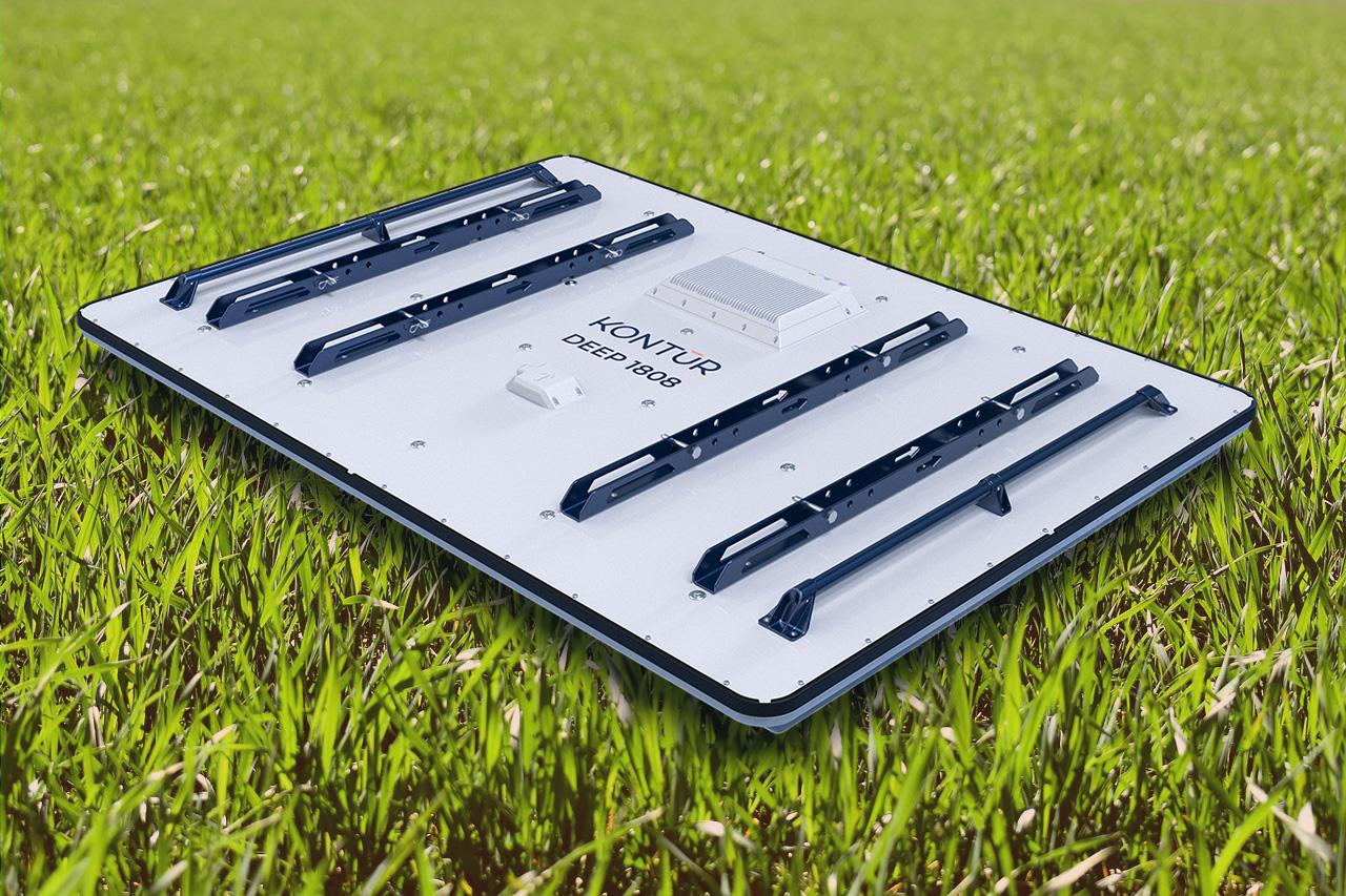
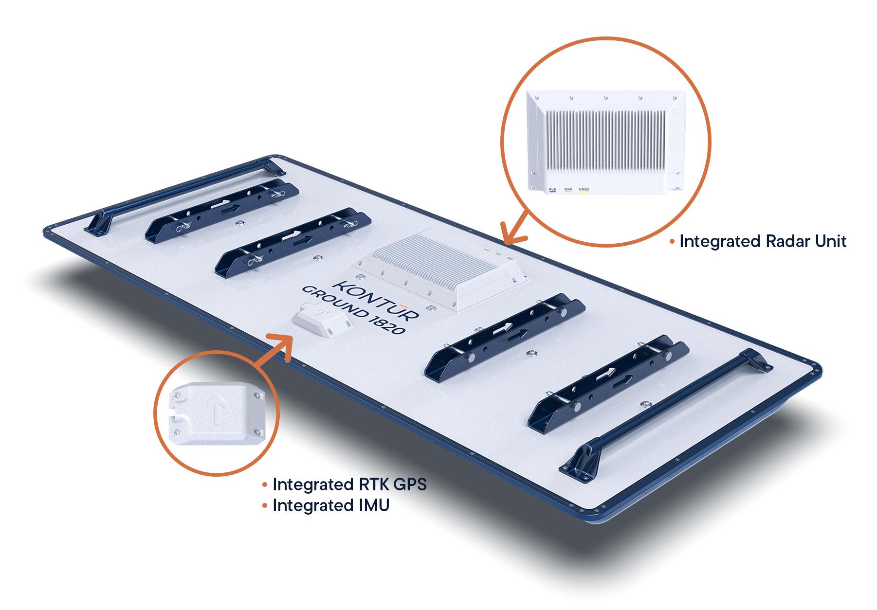
The new Mk6 line of sensors offers several improvements over current GPR sensor technology:

  • Integrated Radar Unit
  • Reduced hardware signature
  • Integrated RTK GPS
  • Integrated IMU
  • Frequency range from 30MHz to 4,500MHZ
  • Available in multiple widths
  • GROUND, AIR & DEEP series

* Mk6 product series is not available in the USA. Pending FCC approval. Mk4 product series is available globally.

Workflow

Examiner Collect

Step 1 – Capture

Large 3-dimensional subsurface areas are easily and accurately captured using Examiner Collect and the Navigation Assist.

Examiner Specialist

Step 2 – Analyze

Examiner Specialist is designed to assess and analyze 3-dimensional data in minute detail.

Examiner Explore

Step 3 – Visualize

Examiner Explore presents analyzed GPR data in an easy-to-understand way by automatically extracting and visualizing the key information, greatly simplifying reporting and decision-making.

Examiner Explore

Step 4 – Act

Taking informed decisions and actions based on true data are vital to any project. This greatly reduces risk and ensures that a budgets and commitments can be met.

Mk6 Series 3 models

Learn how Kontur's Mk6 Series can help you!

A 30 minute phone call can show you how the Mk6 series fit with your applications

Our Vision

”Subsurface insights for safe and thriving communities”

Have you ever thought about the benefits of having one GPR system that can be utilized in a variety of business areas? Our solutions are designed to be versatile and adaptable, making them applicable in infrastructure, utility mapping, railways, and mine detection. Use the same equipment for a variety of surveys.

One System many Applications

Documentation

EU Declaration og Conformity