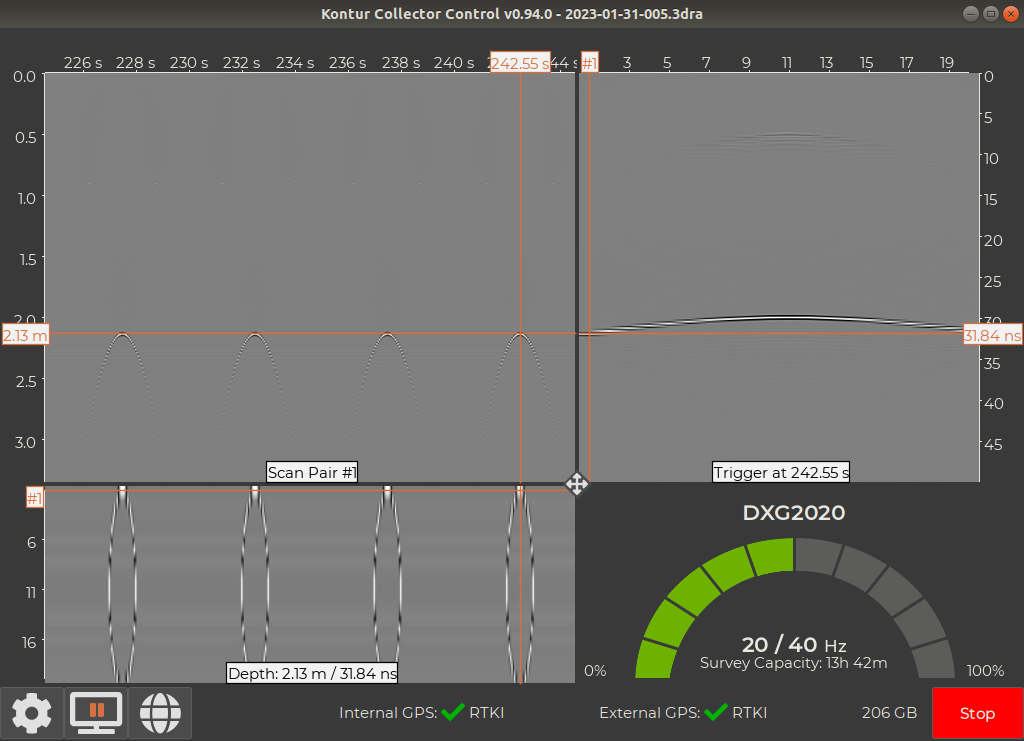
Products

Software

The Examiner universe is built to handle large 3 dimensional data sets with ease. Fast, intuitive and user friendly. Leading the way in GPR processing platforms.

Create Reports Effortlessly

Our sensors collect large, detailed subsurface imagery. Kontur provides platforms to visualize complex subsurface data in an efficient and easily understandable environment. Making reporting and extracting valuable information more effortless and a streamlined way to create and share projects with your colleagues and customers.

The Software

Examiner Collect

Examiner Collect

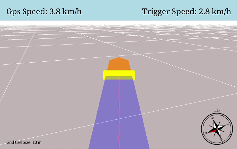
Specifically designed for optimal data capture in the field. This application allows the users to tailor the data capturing settings to the survey requirements like depth of investigation, data quality and density, and driving speed. The embedded Navigation Assistant provides real-time visualization of vehicle trajectory and surveyed area. Live monitoring of GPS accuracy ensures optimal data positioning. Advanced users may customize collection sequences.

Examiner Specialist

Examiner Specialist

Examiner™ Specialist is designed to easily process and analyze large GPR projects and still be the fastest GPR processing software in the industry. It provides a 3-dimensional, georeferenced view of the high-quality data captured with our sensors. A three-slice view allows users to easily navigate within the data volumes for detailed analysis and to export their data into actionable reports.

Examiner Explore

Examiner Explore

A cloud-based application aimed at asset owners, maintenance organizations and users with little to no GPR knowledge for large projects.Automated analysis provides easy-to-understand information of asset conditions and suggests areas of interest for further deep dives.The user can create customized high-level quality indexes of their projects.Sharing of information and reports enabling more informed, data-driven project decision-making, and optimize asset maintenance priorities.

High Performance

Examiner

Large survey collection and performance with views in 3D and geospatially referenced.

The Examiner™ features tools that assist our customers' key tasks.
Providing Pavement Analysis features that are designed to assist in Understanding thickness, areas of distress, cracking, and more.

Examiner

3-dimensional plotting of features and subsurface layers

Map layers of the subsurface rapidly using unique 3-dimensional tracing tools to produce thickness maps and condition assessments. Plot objects with geospatially referenced annotations and can be used to pinpoint locations of interest and map buried utilities.

Examiner

Export Options

Examiner™ provides export options to all common format types and platforms used in the industry. Including GIS (GeoJSON), CAD (DXF/DWG), SEG-Y, ASCII and Google Earth (KMZ).

Import supplementary survey information to better understand the data and results. Including video integration, AutoCAD, Georeferenced Imagery, Shapefiles, and more.